I may not be the only long-distance tourer to feel a dose of discomfort when a tour is completed. We - wife and I - cycle regularly at home but touring means vacation and, when it's over, it's time to resume work. So, after the conclusion of last year's tour in Austria and the Czech Republic, it didn't take long before thinking of another self-arranged, self-guided multi-day ride for August 2024 to fit into a couple of weeks at disposal.
At mid-age, it would be easy to browse through plenty of organized package offers. Something interesting is already on the market although it's like choosing a confectioned dish on a menu. Go here, sleep there, eat this. For me, half of the fun is composing the project before enjoying the real thing. The freedom to define the stages' length, climbs, stops, visits, and/or rest days to comply with our fitness level and with sightseeing.
No racing-mode, no hurry. Our approach to bike touring is simple: savoring the beauty around us at moderate pace. That priceless sense of freedom known to most cyclists.
Our homecountry Italy isn't a bad place. One among the richest in terms of landscapes, art, history, food, and cultural diversity. Valid reasons for having a good time in general. By living at the foot of the Alps I thoroughly enjoy the generous cycling playground offering endless possibilities. Off-tarmac in particular. But regarding long-distance cycling though, Italy's infrastructures - dedicated cycling routes - are a few notches below those found in other countries.
Italy has local excellences scattered here and there but lacking continuity. Pity. For example, a journey of one-thousand kilometers would require riding on dangerous shared roads for too long. Well, in this sense, I can confirm that the neighbor's grass is much greener. Simple reason for looking beyond our domestic borders when planning long-distance projects.
Austria is probably my preferred cycling destination for the overall quality of its infrastructures. Well developed safe cycling routes, mindful drivers, friendly environment, ease and offer of accommodation, and - not least - spectacular views.
English is widely spoken but an unpretentious knowledge of the local language can be of help on top of gestures.
The varied alpine territory is a bounty of valleys, lakes, and peaks, that please the eye at all time. And, climbs of course.
As usual, the tour concept would preferably focus on a loop for ease of logistics as, it goes without saying, there's no need to organize the return to the starting point. Which, anyway, would be possible by using the efficient Austrian rail network allowing bikes aboard.
WHERE?

Selecting the start/end point in Tarvisio came easy as a piece of my heart lies there since the days of my army service with the Alpini, the Italian mountain troops. I hiked, climbed, and back-country skied extensively this northeasternmost corner of Italy which is a true jewel. It's a pity that the barracks complex where I had stationed has been inactive and abandoned for years. Same fate as many other military quarters in the region of Friuli as former Yugoslavia wasn't an enemy anymore.
At stone's throw are the regions of Carinthia and Gorenjska beyond the borders with Austria and Slovenia and these are superb as well. We (Deb and I) had enjoyed the enchanting wilderness here - hiking, climbing, cycling - on several occasions and returning is always a special treat.

HOW?
I tailored a counterclockwise loop by entering Slovenia first, then veering north into Carinthia, Styria, Upper Austria, Salzburg, Carinthia again, and back to Italy.
The Salzkammergut (Lake District) is dotted with lakes of various size and the Salzkammergut Radweg (cycling route) touches most of them.

The official GPS tracks for the extensive network of cycling routes are available from various sources and can be conveniently combined to compose the desired route. I typically do so in advance and visually follow the track on the display of the Garmin eTrex mounted on my cockpit.
A GPS unit is a precious tool also in case of forced detours. Not indispensable though as moderm phones have mapping apps - also working offline - despite being energy-hungry.
I also like to create and print small profile labels for each stage also to be kept on the cockpit for quick reference (example image).
Another aspect considered was to follow the rail network. With all accommodation booked in advance it takes to reach each day's destination at any cost regardless of the phisycal condition, possible mechanical failures, weather issues, or other needs.
If so, hopping on a train with the bike(s) could be done with ease of mind.
Good news was that our friends were also interested so the team of four will be the same as last year. Same strategy of choosing and booking all accommodations months in advance, then requiring to evaluate and define each stage based on distance, effort and, possibly, the amenity of the location. Not a quick task as a safe overnight storage for the bikes is a necessity. Possibly, we always prefer B&Bs or apartments over conventional hotels. A lengthy task which was completed by April.
Below is the ridden route.
Eleven active stages plus two "rest" days, and a bonus day ride at the end.
With respect to the intended planned route, the only variations occurred were the shortening of Stage 7 - by about 70 Km (44 miles) - to reach the city of Salzburg via a different route, and the initial portion of Stage 8 - by about 60 Km (38 miles) - done by train. The first was decided to allow spending more time with local friends, the second due to a storm.

From left:
Ant (me), Deb, Barbara, Flavio.

Same conventional (motorless) bikes as last year for the four of us.
Ant and Deb: aluminum hardtail MTBs with riser bars, dual chainrings, 22/36 lowest gear, and 700c “gravel” tires.
Total weight of each fully loaded bike including the rear panniers, handlebar bag, and extra water/food, was about 30 Kg (66 lb). Tools, some spares, puncture repair products, and locks are of course always part of it as well as rain gear and warm clothes.
A backpack on top of the panniers is a proven good solution to hold valuables, including a notebook, to be easily removed in case the bikes must be left temporarily unattended.
Flavio and Barbara: aluminum road/fitness bikes with flat bar. Same luggage strategy.
ROADBOOK
- Total 968 Km (602 mi) and 8450 m (27,723 ft) of positive climb
- Of which 54 Km in Italy, 206 Km in Slovenia, and 708 Km in Austria
- 11 active stages plus one rest day in Fuschl am See and one in Zell am See
- 1 bonus stage day in Tarvisio, riding up to Rifugio Zacchi
- Total moving time: 68h36m
- Longest stage 115 Km with 1117 m of positive climb
- One tiny puncture (Flavio) fixed with repair can
- Hot conditions for the entire duration with days around 35C (95F)
- No rain. Just a sprinkle (a storm was avoided in Salzburg)
- Not many loaded cyclotourists encountered. The 95% of bikes seen around were
e-bikes
- Except for some 20-30 Km (12-19 miles) of good unpaved paths/roads, the rest is
paved, almost always smooth, and free from debris or trash
- This tour is not suggested to novice - motorless - cyclists due to demanding climbs with
steep sections. The recorded track shows grades above 21% (!!!)
A RELAXING DAY BEFORE THE START
Driving from home in Torino we arrived at our B&B accommodation on Friday, that is two nights before Sunday's first pedal stroke. We had been here several times in the past and the hosts are now considered as friends. Perfect stay. Located in quiet Coccau di Sopra just above Tarvisio with spectacular views over the Mangart group.
Bikes assembled, stowed in the garage, and ready for action.

The Great War Theme Park Abschnitt Saisera is located in the Saisera valley a handful of miles west of Tarvisio. It's an open-air museum dedicated to the Great War, showing the remnants of the "Vordere Saisera” line, one of the two defensive lines built by the Austro-Hungarian troops during the conflict to counter the Italian attacks from the Dogna valley to the south. Until 1917 the Canale Valley - where Tarvisio is - was part of the Habsburg Empire up to, to the west, the town of Pontebba.
A rebuilt barrack, trenches, cannon and machine-gun posts in tunnels dug in the rock, are reminders of the precarious life of the soldiers during a horrible war. The Canale Valley is today a homogeneous mix of Italian-, Friulano-, German-, and Slovene-speaking population where traditions and cultural diversity are nothing but a unique great asset.
This hike also combines the Forest Sound Track trail through a spruce forest. Some of these selected trees yield high-quality resonance wood used for the manufacturing of violins and other string instruments.
Tarvisio and surroundings (info)
Abschnitt Saisera (info)
Tracklog of the Abschnitt Saisera hike
___________________________________________________________________
Stage 1 – Tarvisio (I) to Kranj (SLO) – 89 Km, 785 m elev. +

Other than the water bottle, we load two extra liters of water each onto the panniers and we'll do this every morning, as water may not always be found when needed. Going dry would be quite bad in this weather.
Let's move and catch some air! We descend to Tarvisio from Coccau on the Via Romana, actually the path of former Via Iulia Augusta built by the Romans over two millennia ago. Blue sky and dry air yield a grand panorama.
A few kilometers and in Tarvisio a moderate access ramp takes us on a section of the Alpe Adria Cycleway. It's a perfectly paved, two-lane superb "greenway" built on the seat of the former dismissed railroad - a new, more efficient railroad now bypasses the urban area. We pass the former Tarvisio Citta' tiny station which I recall as a fairy-tale feature emerging from meters of snow during my army service. Pity that it's now closed and unused, it would serve as an ideal food/waterhole point for cyclists.
A little further on we make a right at an intersection towards Slovenia. Going straight here would take us to Austria.
A couple - two-ebikes, one of which pulls a trailer - is gazing at the signs. They rode here from France and we exchange some small talk. Not too long of a conversation as we're eager to kick. A bridge overcomes the Slizza Gorge which we'll visit upon return. Here, a gentle 2% grade takes us to the intersection for the Lakes of Fusine to the right, and we go straight to the Rateče border in five minutes. The once highly-guarded spot is now a fast rolling passage although most everybody stops at the white milestones for a couple of portraits. Ourselves included.
In Slovenia we soon enter inside the boundary of the Triglav National Park and we spot the highest mountain in the country peeking from behind other summits. The one sketched on the national flag, the "Three Horns". We're still on a "greenway", locally named D2, until Mojstrana where we abandon the valley bottom and turn right up a 7% grade for a few Km. I had planned this variant to ride in the woods rather than in the valley bottom that approaches Bled and, so far, we've ridden in the shade for most of the day. Bled is nice and charming but no, thanks. Said to be #1 tourist destination in the country and yes, it's packed to the rim. Long-gone are the quiet days of our first visit here in 2002. We stop for lunch, buy something at a self-service restaurant and consume it outside next to the bikes. It's miserably hot even in this shaded corner.

Our hotel is namely a 4-star without air conditioning. One at least expects the bathroom sink to be working but it's otherwise clogged so I remove the P-trap to dislodge the stuck plug. I should invoice them for the plumbing work!
Stage 2 - Kranj to Slovenj Gradec - 113 Km, 1016 m elev. +

Today it's partly on official cycling routes and partly on minor roads. Not many cyclists around. Probably none.
We've been to Ljubljana in the past so we stay north of it. Podgorje, Kamnik, then a number of small villages. Like every morning, the accomplished task is to stop at the first available supermarket and buy water and provisions for the day. We never stop for proper lunch as the following hours would be brutal with a full stomach.
Hilly terain with ups-and-downs.
Some 10% grades. Mostly rural territory with cropfields means riding mostly under the sun and it's scorching hot.
We pace through the long stage with frequent stops when finding shaded spots. When booking all accommodations in the early months of this year, the offer was quite limited then suggesting that the area isn't much popular. If Kranj was what it was, what to expect from smaller Slovenj Gradec? Well, surprise. A lovely, clean small town without tourists. Tiny, then one can't expect a burst of life, but a pleasant experience.
The apartment on the ground floor is modern and classy, and has a private garden. We had received instructions for using the bike lockers in the parking lot and find ours, but a car is parked close to it preventing the full opening of the door. Putting the bikes in the private garden proves the easiest of solutions.
Stage 3 - Slovenj Gradec (SLO) to Hautzenbichl (A) - 113 Km, 862 m elev. +

After a generous breakfast in the main square, a few kilometers take to Dravograd where the Drau river veers east but shortly after following it upstream to the north one finds himself in Austria. This is the easiest crossing into the country as, west of here all the way to Italy, it takes mountain passes on shared roads to cross the Karawanks range. The route develops upstream the flat Lavant valley which progressively picks up to a modest 3% grade then cresting in sight of the Mur valley and Zeltweg.
Our B&B accommodation is in an easily reacheable suburb to the east of Zeltweg away from the upcoming MotoGP frenzy in town.

Another very hot day with little shade. The strong headwind found in the Mur valley does't have a cooling effect but rather that of a hairdrier pointed straight to our face. We have - yes, have - to stop in the shadow of a roadside chapel about 10 Km or so before our destination. I even think I can wait here until dark before resuming! Then, the idea of a cold shower helps collecting the necessary mental resources to tackle the final effort.
The B&B is located in a residential neighborhood and there isn't much around us. Not much to do or explore either so we opt for buying food at the closest supermarket and dine "tapas style" in our room.
Stage 4 - Hautzenbichl (Zeltweg) to Liezen - 99 Km, 631 m elev. +

Easy day in terms of elevation profile. A stretch of Mur then the morbid upstream of the Liesing valley. Hot day again but the partlally cloudy sky gives us some deserved relief.
We take advantage of the vicinity of a supermarket to buy provisions for tomorrow's breakfast and for the day. Look at these two carrying cartons of food/water around town. Of course I couldn't visit Austria without bringing my "local style" shorts and wear them where nobody else does.
A web search returns the availability of an Asian restaurant as an alternative to the typical meat staple. It turns out to be an excellent eatery with a-la-carte and buffet options. Asian all-you-can-eat solutions aren't always the best but the food looks attractive and we opt for the buffet. In addition to a good selection of greens, vegetables, and ready dishes, a teppanyaki kitchen has a couple of chefs cooking the self-composed plates of raw ingredients, adding the desired sauce which is indicated by a color-code clip we pinch to the plate.
A recommendable dining experience.
Stage 5 - Liezen to Bad Goisern - 73 Km, 533 m elev. +

Relatively easy stage today with some steep sections as we leave Styria for Upper Austria. Along the way we find the perfect sheltered pic-nic spot with tables and benches, and a nearby water fountain.
We're happy to return to a favorite accommodation which, years ago, was chosen as a 10-day hub for day MTB rides and hikes in the surroundings. Things may change in time and they did, but not for the better.
An unexpected disappointment. The "scissors" effect. Higher prices with a consistent reduction of the quality of service. So-so rooms and food went from great to sub-average. Different treatment for one-night-only guests? Whatever.

The idyllic UNESCO town of Halstatt, on the homonym lake, wasn't an untrodden location even years ago but it has become a place to be avoided in peak season.
If walking among the crowds is a nightmare, imagine going through the main street by bike. Which is allowed with a 30 Km/h speed limit, but clogged by herds of erratic folks pretending the entire street is their own. The town is then best enjoyed when seen from afar rather that from within. Most tourists are Chinese nationals visiting the "real thing" as a replica of Halstatt was built in the Chinese province of Guangdong in 2012.
Stage 6 - Bad Goisern to Fuschl am See - 115 Km, 1117 m elev. +

Today we enter the Salzkammergut (Lake District) region. Lakes, climbs, lakes, climbs, lakes. After passing through Bad Ischl, the elegant town chosen by Emperor Franz Josef I and wife "Sissi" as their summer residence - the "Kaiservilla" - we're riding alongside the Traunsee up to Gmunden laying on its northern tip. It's hot again and stopping for a snack and some rest in the leafy lakeshore public park is an occasion to chat with a guy taking a cooling break from a motorcycle day trip. He informs that the Traun is the deepest among the regions' bodies of water and mentions the "Sleeping Lady", that is the silohuette of the mountain across the lake. On a previous visit to Gmunden with our friends from Braunau am Inn we fancied about a possible future shared hike up there while tasting the Schaumrolle, a local pastry, at an elegant cafe'.

We abandon the shore and go west reaching the northern tip of the Attersee. After a while, the official route diverges from the shore and goes up. And steep it is, with short sections at 17% grade, for no particular reason if not that of keeping cyclists away from the already safe lakeshore road. Austrian drivers are quite considerate and respectful of bikers. There is some view from the top albeit not worth the effort and especially with the heat.
Finding a two Euro coin right there isn't much of a reward but why leave it there?

Two more lakes on the way before the final one for today: Mondsee and Wolfgangsee with the elegant town of St. Gilgen.
Then, the smaller Fuschlsee where we put our bikes to rest at the B&B for a full day. The actual reward for the day is finding the perfect restaurant and a table on a pier with the sunset view.

Fuschl am See is very small. The only store we find for tomorrow's breakfast provisions is unmanned. We get in and grab a few items which we scan for payment with card. Although rare to find, I'm glad to learn that honesty isn't completely extinct on Earth.
The rest day isn't meant to be unproductive as the 14-Km walk around the lake was already planned. And, within it, an unmissable lunch at the Schloss Fuschl Fischerei. Thanks to our friends from Braunau whom took us there in the past! All they serve is delicious smoked trout (and occasionally other fish) from the lake. There is no service at the outside tables. Find one, then get in line at the counter where the desired amount of fish is paid by its weight. Add Kren sauce, bread, and beer, and the perfect meal is served.
Stage 7 - Fuschl am See to Salzburg - 25 Km, 124 m elev. +

Another reason for the extra day in Fuschl, being a Saturday, was for the possibility to meet our dear friends from Braunau. They couldn't come see us but they were free on Sunday, so we decided to shorten today's stage - originally worth 94 Km - and head straight to Salzburg instead of the intended route north which would have touched other minor lakes. Only 25 Km then, and quite fast. The weather is anyway not cooperating, with storms to the north, so no complains for such decision to transform a stage into a mere mellow transfer.
Our accommodation is centrally located and quite convenient for wandering around. We've visited the city a number of times and returning is always desirable.

Good to see our friends after a year. We walk around the elegant city under a light drizzle until it's time for the ritual - almost - dinner at the Augustinerbräu Kloster Mülln, Austria's biggest beer tavern since year 1621. Get in, "rent" a mug, rinse it, have it filled with Augustiner brew, seat yourself in the garden or in one of the 5 or 6 large halls, and go buy "delicatessen" by the indoor stores/stalls. Or, bring your own food. Good beer as always in a great joyful atmosphere.
Stage 8 - Salzburg to Zell am See - 47 Km, 687 m elev. +

Riding south mainly on the Alpe Adria cycle route, today's stage was meant to be 108 Km. It's still raining after the check-out and by a quick consultation of the real-time radar conditions on a couple of websites we acknowledge that the rain is, and will be, lingering for approximately the first 50 Km into the stage. We then decide to take advantage of a train ride up to St. Johann im Pongau. It's also an occasion to test the local bike-on-train system which turns out being quite easy and efficient. Salzburg's Hauptbahnhof station is only five minutes from us and, to avoid possible online mistakes, we buy our tickets at the counter. Convenient elevators take us and the bikes to the platform. The convoy comes in and the cars for bikes are clearly marked with an evident logo. The available space aboard is sufficient for stowing our four bikes without the need to remove the panniers, the doorstep is level and we just roll in. Two bikes could be secured with an existing strap while two were just leaning against a row of retractable folding seats, anyway firm and safe. The local-type train covered 60 Km in one hour approximately and left the rain behind together with the flat portion of the stage. Easy in, easy out, and we're spinning wheels again.

A few profile "teeth" later we abandon the Alpe Adria and here take a short but very steep descent towards our destination. We'll ride the same way back, then up. And steep it is, as the recorded track will later show a 21% grade figure. After the plunge it's some 25 Km at moderate uphill to Zell. Ready for another rest day when, as in Fuschl, we'll walk around the quiet lake for 12 Km.
Stage 9 - Zell am See to Spittal - 104 Km, 1103 m elev. +

The first 25 Km come easy by tracking back the same route. Then there's the infamous 21% grade step up to reach the intersection with the Alpe Adria. Could it be for us being "fresh" after the rest day, and for the morning isn't too hot yet, but we don't dismount to push.
After this point the dedicated path runs alongside the B167 road inside two lit tunnels - no own lights needed. The first is separated from the motor traffic while both bikes and motor traffic share the same, straight, second shaft for its length of almost 2 Km. Plenty of heavy trucks. The noise is impressive and disturbing. The 5-6 minutes spent inside the tunnel seem eternal and once out in the daylight we stop for a snack and recovery by a sheltered bus stop. Silence is highly appreciated!
The next 20 Km are pleasant until a couple of Km right before Bad Gastein which we see high up above us. Ramps at 13%. An elderly lady smiles and shouts: "ohne Motor, super!" (without motor, great!). Sign of the times.
A boisterous waterfall runs through the middle of town and we're not alone looking at it on the popular bridge. It takes a while before we can shoot photos without intruders.
Another 6 Km of moderate climbing take us to the Böckstein train station and the ticket booth is a bit past it. There's no road pass to overcome the Hohe Tauern range here. The notable one is the fabulous Grossglockner Strasse to the west. All bikes and cars must then get aboard the special convoy shuttle running back and forth between here and Mallnitz. Hourly scheduled departures.

Where to wait on the platform prior to the train arrival isn't clear for first-timers. An experienced Italian guy indicates where, which is some 150 meters from the station and it's where all incoming bikers congregate. That is where the cargo wagon, last of the long convoy, stops. At the other end is the passengers wagon and in between are the open, roofless wagons accepting cars.

We push our loaded bikes inside the cargo and an employee places them head-tail alernately sideways one against the previous. Then, when a number - say 20? - is reached, he pulls a single strap securing them as a whole pack. Meanwhile all bikers walk all the way to the first passengers' wagon and board for the 10- or 12-minute ride.
Upon arrival, the employee pulls the bikes out and places them into front-wheel racks or on kickstand if present. Our four bikes are the last in the pack and are pulled out first. We're back in Carinthia.
Time for a snack and we sit on a couple of benches outside the station building.
The 7-Km descent on shared road is fast and fun. No traffic though, just a couple of vehicles being a dead-end valley. Another 35 Km to our Pension in Spittal without the need to go in search for a restaurant as we dine in. A couple of kids play on a swing in the well-groomed garden while we have a deserved meal.

Worth mentioning is Peter's Rad'l Rastplatz we found some 30 Km from finish. Perched in the woods, a local resident has set a refreshment/utility station for cyclists. Everything is for free unless one wants to drop an offer. Again, an honor-based solution. Name something and it's there for sure. Fresh fruit, candy, cookies, energy bars, socks, sunglasses, vitamins/minerals supplement tablets, first-aid items, handkerchiefs, lip balm, bungee cords, any sort of tool for use, chain lube of various sorts, and much more. Amazing.
Bravo Peter!
Stage 10 - Spittal to Klagenfurt - 81 Km, 282 m elev. +

Easy stage along the Drau river. Still on the Alpe Adria cycleway up to Villach where we stop in the coolness - so to say - of an urban park on the riverbank.
A fountain in the river is pumping high coordinated water jets. Chaise-longue chairs are mounted on four springs. Nice lulling effect unless a friend violently shakes it to mess your just-refilled stomach up.

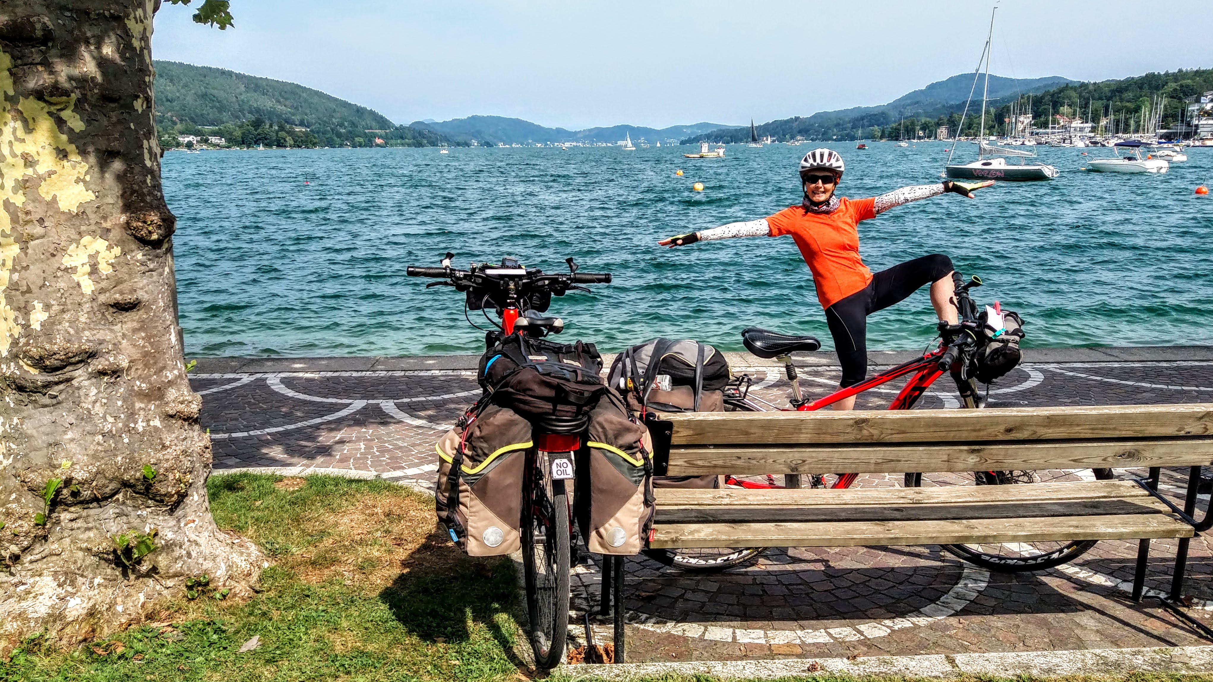
Last "tooth" before elegant Velden where we take a break by the lakefront. Time for Wörthersee, largest in the region. Narrow and some 18 Km long, we ride on its northern shore which, contrary to the southern shore, is developed and dotted with small villages. The cycling path is separated from the main road and an easy ride to Klagenfurt, the region's capital. The GPS track leads us right to our apartment for the night. The amiable host Sara has a few pet hens and one of them is extremely curious and friendly while we relax in the garden. She is later much interested in the Laugenecke I'm eating - defined by some as "the love child of a brezel and a croissant" - and tries to hop on my lap.

Now, almost at the end of the adventure, we finally find a remarkable beer. Until now it was "average", drinkable brew without notes of merit. Our host suggested a couple of eateries for tonight and one, other than being full, seems a bit upscale and boring. The estimated waiting time is anyway about 30 minutes so we check the second option which is the Bierhaus Zum Augustin. An appealing old, cozy brewery with indoors and inner garden outdoors spaces.
Typical local food and a great craft beer, so "noch ein grosses, bitte!"
Highly recommendable.
Stage 11 - Klagenfurt to Tarvisio - 71 Km, 735 m elev. +

The last stage always starts with a pinch of sadness. We check out and stop at a nearby supermarket for provisions before heading to the lake's south shore, shadowed in the morning, where the separated lane provides a smooth ride. Oustide of Velden we spot a chain store which Deb has been searching for days and at least we find one. We briefly see the Drau again before taking a steep grade up under the sun and, nevetheless, it's very hot again requiring a couple of stops under trees. Not a break even on the last day? We don't know yet but it's going to be like this all day.
Last lake we see in Austria has a questionable name for English-speaking folks.

We keep pace up the moderate hill towards the border, but panting for the heat, and we need another stop in the shade of a roadside grain elevator to recollect mental strength. When our wheels roll into Italy we stop again to cool down and, as we know from previous visits, in preparation for the final but hard climb topping a short but sincere 20% grade before reaching our starting point at the B&B.

A spectacular view south from Coccau di Sopra over the Mangart group pays off for the effort. But we must be quick in taking photos for it's torturing torrid.

The homecoming.
We touch base all safe and sound!
Tonight plus two more at the B&B will allow to benefit from the local generous territory.
Bonus Stage (12) - Rifugio Zacchi - 39 Km, 575 m elev. +

No need to wake up early. No chores, no packing. Today we're riding - without the bags! - up to Rifugio Zacchi, a mountain hut at the base of Mount Mangart that shares its summit with Slovenia. Deb and I climbed it years ago via the Slovene ferrata.
Other than three available hiking trails, the hut is also accessed by an unpaved service road. Barbara has narrower tires and when the gravel becomes loose and thick in spots we decide to lock the bikes to a tree and proceed by foot for the remainder stretch of 2 Km to the Rifugio.
The hut serves hot meals and all of the outside tables are taken by patrons speaking a number of different languages. Only a few are under trees and no, please, so no complaints by taking an empty one inside where we appreciate the soothing breeze flowing through the room. Barbara has the courage to order frico, a typical local dish served with polenta. A delicious, generously sized pie made of potatoes, onions, and - mostly - local cheese. Steaming hot just out of the oven. Winter be, I wouldn't hesitate to fulfil my craving for it but definitely not on a hot summer day. The rest of us have a more adequate, and quite good, potato salad.
The food is excellent and so is the friendly service.
We have a chance to pass by the popular Fusine Lakes where we stop on return.
Stunning colors and panorama.

The plan for tomorrow is to take a walk down the Slizza Gorge ("Orrido dello Slizza" in Italian language) before driving to Arnoldstein in Austria and shop for food to be taken home, then to be consumed pretending we're still on vacation.
Along with the Drava in the Alto-Adige province ("Drau" in German), the Slizza is the only stream flowing outside of the Italian borders. A steep descent on man-made log steps takes to the bottom of the cool gorge soaked by gentle-flowing, crystal-clear shallow water. Like most streams and rivers found in Slovenia, the pale turquoise-hue is due to the local limestone rock. The trail has protection rails - recently restored - and follows the left hydrographic bank, upstream, where ponds are enjoyed by a few floating humans. After a short relaxed walk it's time to climb out of the depression and, for loop completion, tread the same bridge we rode on two weeks ago.
___________________________________________________________________
CONCLUSIONS
Another pleasant tour under the belt. It can't be considered an adventure when all accommodation is booked, body is fit, the GPS shows the route, the infrastructure is excellent, data/wifi is for granted, there are no inconveniences, the roof is reached before dark, there's a shower, and food is on the table. No quest for the unknown.
Of course it takes determination to achieve the daily tasks but, in my opinion, it has been a good mix of variety, views, effort and, above all, the great company.
If I haven't mentioned it enough already, the only enemy was the heat - same as last year. We have to accept that August has become a hot month in recent years also in central Europe and even at higher elevations in the mountains. Unfortunately August is the only typical possible month for our vacations then wondering if it would be wise to consider higher latitudes for future tours.
Thank you Team!
The tracklog of the tour is available here:
https://www.wikiloc.com/bicycle-touring-trails/cycling-2024-tour-183378066

If interested, here's the walk around Fuschlsee:
https://www.wikiloc.com/walking-trails/walking-around-fuschlsee-17aug24-183386316
And the walk around Zeller See:
https://www.wikiloc.com/walking-trails/walking-around-zeller-see-20aug24-183388420
___________________________________________________________________
RANDOM PHOTOS
- Likely more to appear soon -

An explanation is needed for our team logo.
No offense intended. As a teasing, or dysphemistic, stereotype term of address, some German-speaking individuals call Italians "baffi neri" meaning "black moustache".
Considering that in some cases the "B" letter may sound as a "P" in German, hence the deliberate "paffi neri" jest!


And here it begins.
Ready to spin wheels!


Back to Coccau!

